Posted on Old Chesterfield Pics, it shows Whittington Hill before some of the houses had been finished, Newbridge St is clearly visible as is the view to the Crooked Spire. Not sure of the year, possibly early 1900 as it featured in the Almanac for 1904.
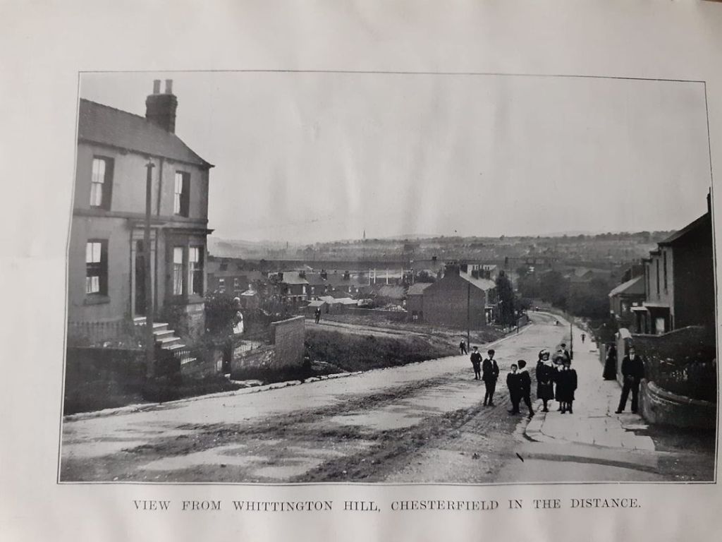
T P Woods Almanac 1904

Ou can see gas thing in the foreground. I throught it was Holland road going across but does not seem to go on other side
Crooked spire
LikeLike
Yes the gasworks buildings were still there in the 1990’s not sure what date they were pulled down. Holland Rd is on the left. It would appear to have been developed into Holland Road between 1899 and 1921. The 1899 map shows the road was named and partially built, by 1921 the road was completed and the entrance to Holland Road ran straight across Whittington Hill as it does now.
LikeLike
Snow on the ground it would be slippy coming down !
LikeLike